Re-Frame Toledo
North Coast Design Competition
Awarded First Prize, May 2014
Awarded First Prize, May 2014
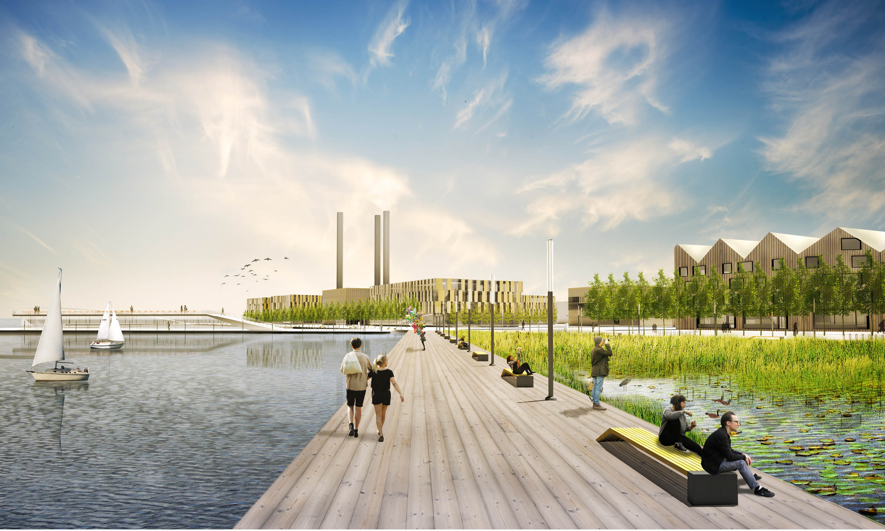
Re-Frame Toledo is a proposal to reimagine how a deindustrialized cityscape can become a highly active and engaging series of public spaces, mixed-use neighborhoods, and nature reserves that help benefit the local ecology. The magnitude in which dredge material is collected in Toledo can be seen as an enormous asset to the city. By incorporating phytoremediation into the dredging cycle and restoring a riparian zone, natural systems continuously clean water while restoring native habitats. Formely the product of a manufacturing and infrastructural landscape, the riverfront can be reassembled with dredge material to delineate relevant urban and landscape contect with the Maumee River.
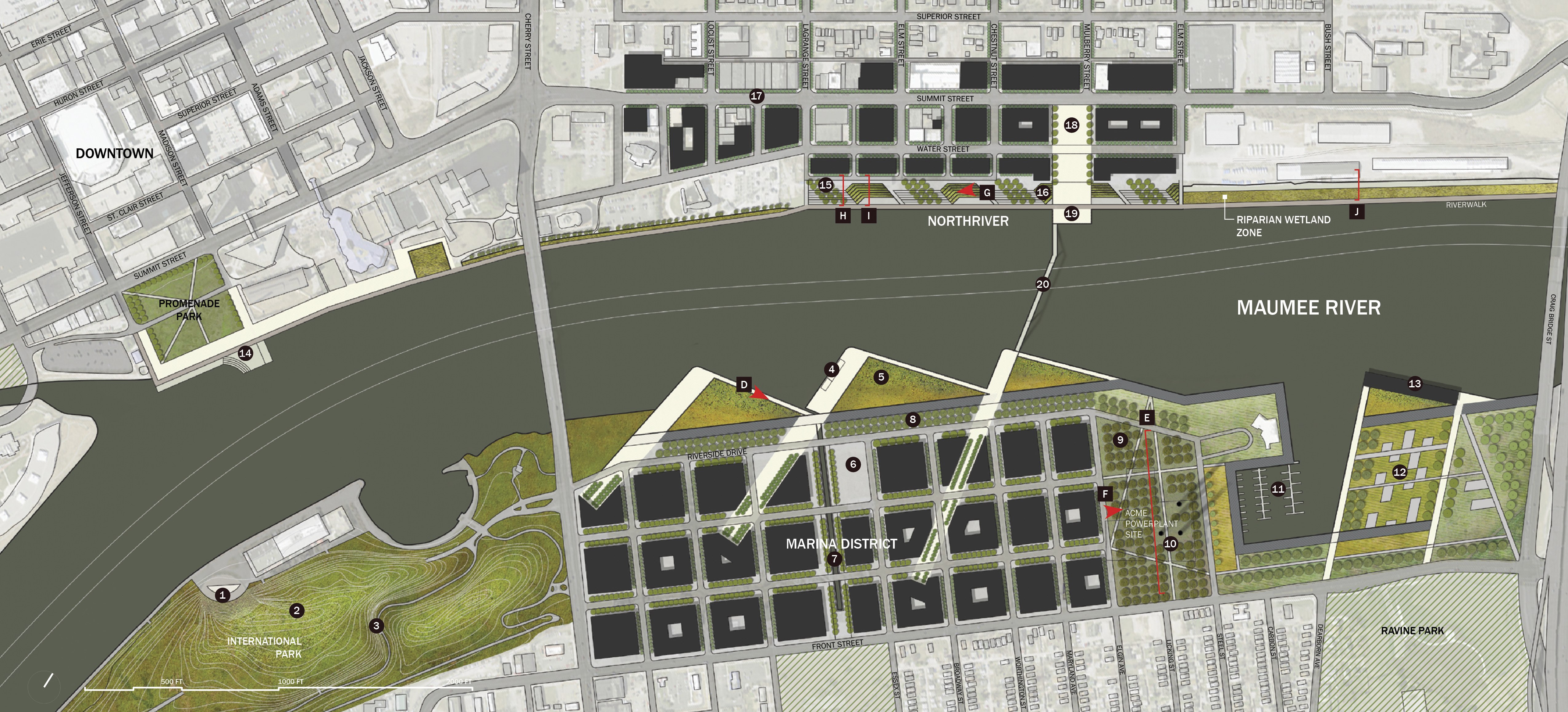
 Overview site plan of project scope
Center for Dredge Research
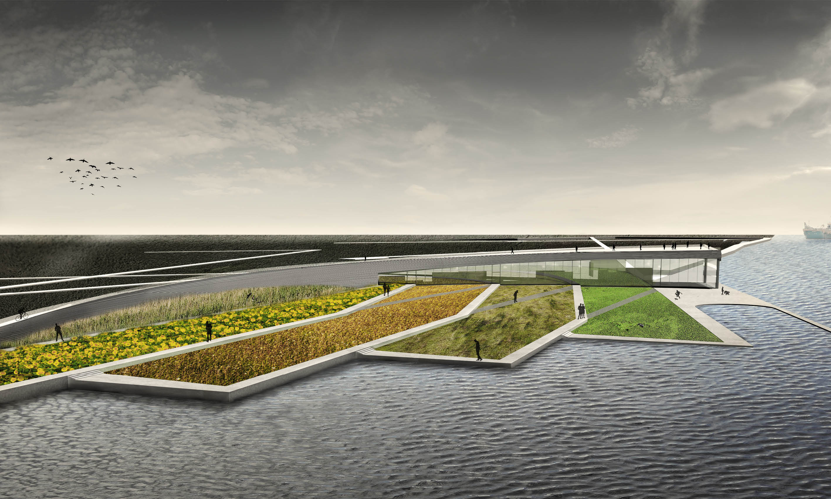 Years of industrial pollution and phosphorus contamination from fertilizers have rendered a polluted Lake Erie. Coupled with the fact that large quantities of dredge material must be returned to the lake bed each year, the dredge cycle can be seen as a useful means of water purification. Re-Frame Toledo incoporates a step of phytoremediation into the dredge cycle as an active means of cleaning the local water ecology. A series of dredge cleaning sites are established along the lakefront comprised of planting veds with native hyperaccumulators. The first such site is located at the Great Lakes Center for Dredge Research (above). Once the sediment is cleaned, the dredge material can be used within Toledo to redevelop the riverfront and create a riparian zone.
 Zone 1: Renewed Urbanism
Once dominated by infrastructual and industrial landscapes, the vacated riverfront has the potential to embody the public face of a renewed Toledo. Dredge material is incorporated into a series of new articulated topographies that instigate public space and urban ecology. A continuous riverwalk on the north shore links downtown with the Center for Dredge Research in a sequence of public attractions and connections to existing neighborhoods. The south shore is dominated by triangulated boardwalks that initiate views between the Marina District and downtown while encompassing new riparian wetland habitates. Once a large deserted swath of land in the center of Toledo, the Marina District is redeveloped into a lively mixed-use neighborhood with ample public space and access to the riverfront. The adjacent demolished Acme Powerplant’s remaining smokestacks are prominently featured amongst a phytoremediating poplar grove as an intersection between Toledo’s industrial past and sustainable future. Finally, a new access bridge integrated both sides of the river more freely for cyclists and pedestrians.
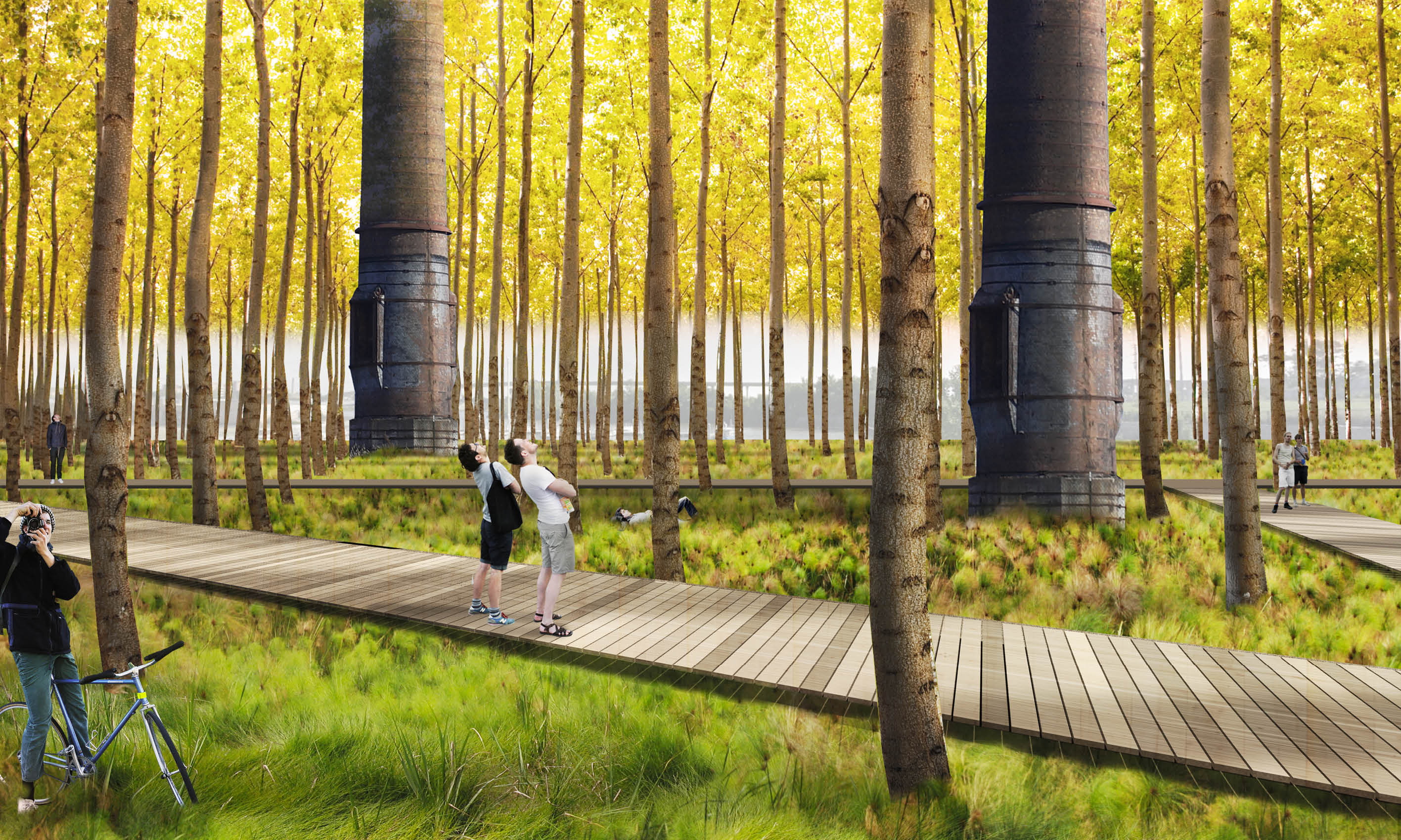 Poplar Grove at former Acme Powerplant
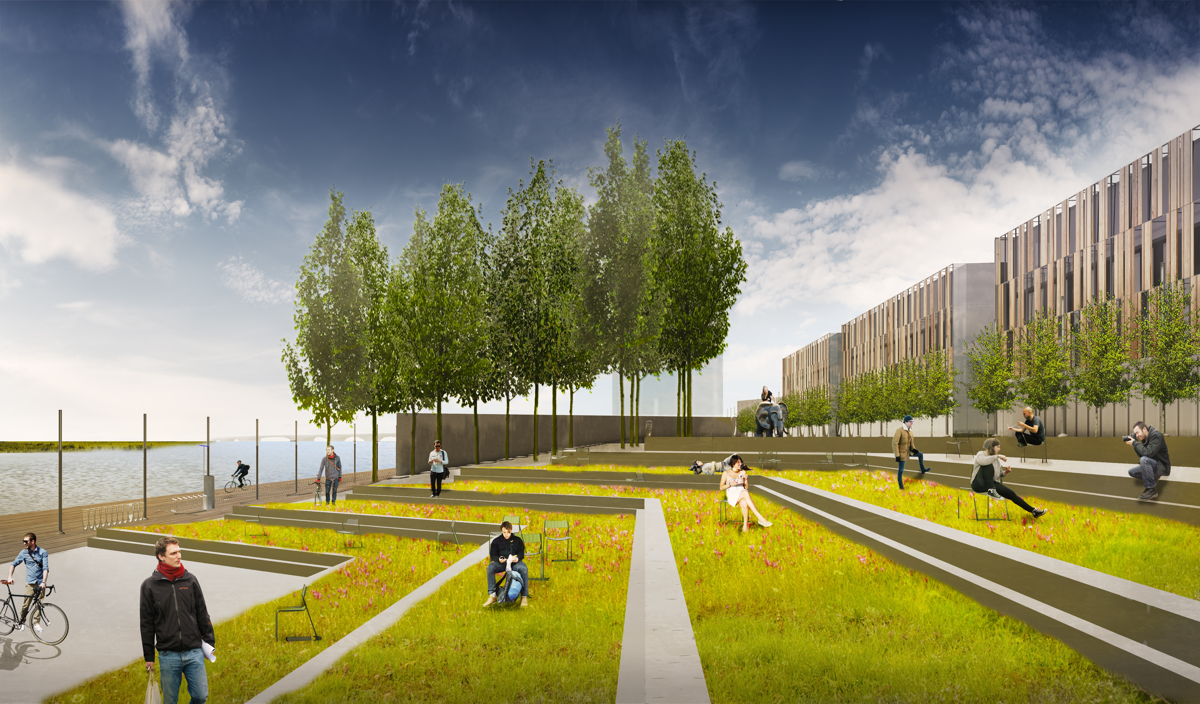 North River neighborhood
 Zone 2: Sustained Ecology
The creation of an extensive succession of riparian wetland zones at the river’s edge benefits the flow of the Maumee River into Lake Erie. Northwestern Ohop was once home to the Black Swamp, a great expanse of wet prairies and marshes that sustained a unique ecosystem while filtering water runoff. Drained to reclaim farmland, the region has lost an important network of ecological functions. For the three CDF sites—Riverside, Penn 7, and Penn 8—a series of topograohic ridges and depressions along with strategic native plantings helps recreate the lost landscape typologies of the Black Swamp. Two such typologies, the deciduous lowland forest and freshwater wetlands, are prominently featured to the public by a sequence of elevated walkways and boardwalks. These Nature Reserves also manage water runoff, passively filter the Maumee River, and control the water table during seasonal flooding.

Freshwater marsh and observation tower